Attractions of Fada N’Gourma and surroundings

Situated in the extreme east of Burkina Faso, the Eastern Region is bordered to the north by the Sahel region, to the south by Togo and Benin, to the east by Niger, to the west by the Centre East and Centre North regions. It covers an area of 46,694 km², about 17% of the national territory. It comprises five provinces: Gnagna, Gourma, Komondjoari, Kompienga and Tapoa. The climate is of the southern Sudanese type characterized by a rainy season lasting five months from May to September and a dry season lasting seven months from October to April. Kompienga province lies between the 800 mm isohyets in the north and 1000 mm isohyets in the south. The Gnagna province is characterised by a South Sahelian climate in the north and a North Sudanese climate in the south. The climate of the area is marked by a dry season which lasts six months from November to April and a rainy season which also lasts six months from May to October. Tapoa province is part of the Northern Sudanese climate which is characterized by two seasons: a rainy season from May to September and a dry season from October to April.
Centre for the Disabled of Mahadaga
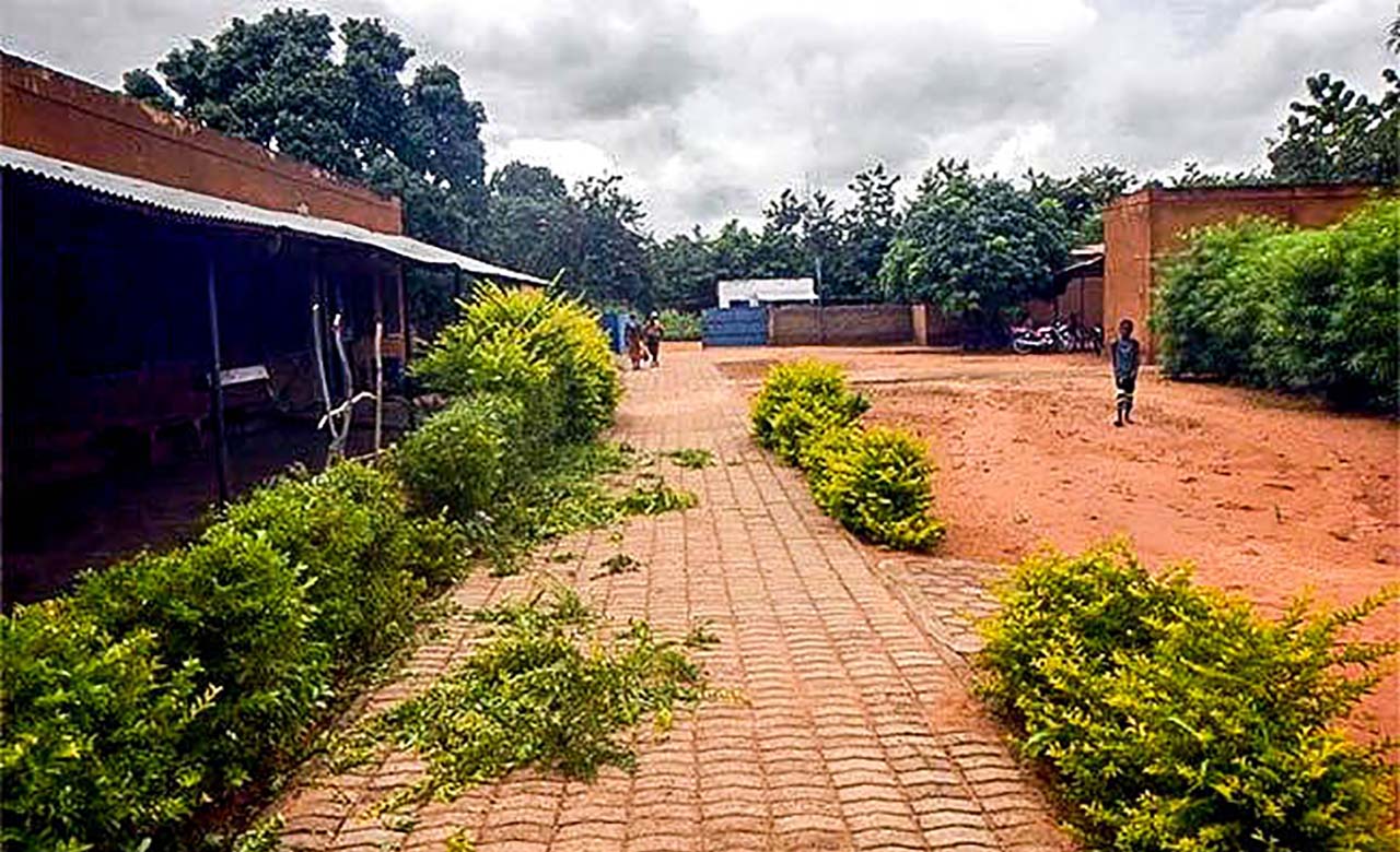
The “Handicapés en Avant” centre was created in 1989 in Mahadaga by Françoise Pedeau. A midwife by training, she was strongly influenced by the situation of a disabled child. Feeling challenged by this situation, she decided to provide him with a wheelchair. In view of the profound change in this child’s life, she continued on this path and this is how the centre was created. Since the opening of the centre, more than 1,700 disabled people have found refuge there. Today, the centre is equipped with a school for visually impaired and deaf-mute children, a rehabilitation centre with an orthopedic
workshop that is spreading throughout the region. Many other actions have been set up independently of the centre. The centre promotes social inclusion, supporting initiatives through microcredits and providing training in several areas.
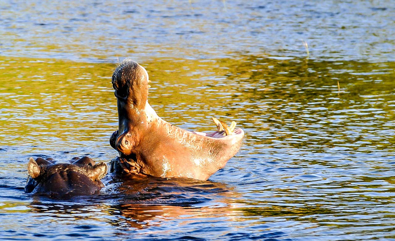
Pama Reserve

The Partial Pama Reserve is located in the southeast of Burkina Faso, precisely 275 km from Ouagadougou. This partial wildlife reserve was created in 1955 and reclassified in 1970 with the main objective of promoting, managing and preserving the natural heritage of the reserve. It covers an area of 223,700 ha and is divided into 4 hunting concessions: Pama Nord, Pama Centre-North or presidential zone, Pama Centre-South and Pama South (red buffalo camp). Sport hunting is organized there every year from December to May. It attracts many tourists and generates revenue, 50% of
which is paid to the neighboring villages and forestry services. These revenues are invested in the construction of schools, health centres, leisure centres, etc. The reserve is home to elephants, hippos, lions, hartebeests, harnessed bushbuck, warthogs, several species of primates, leopards and 450 species of flowering plants.
Gobnangou Cliffs
Arly National Park
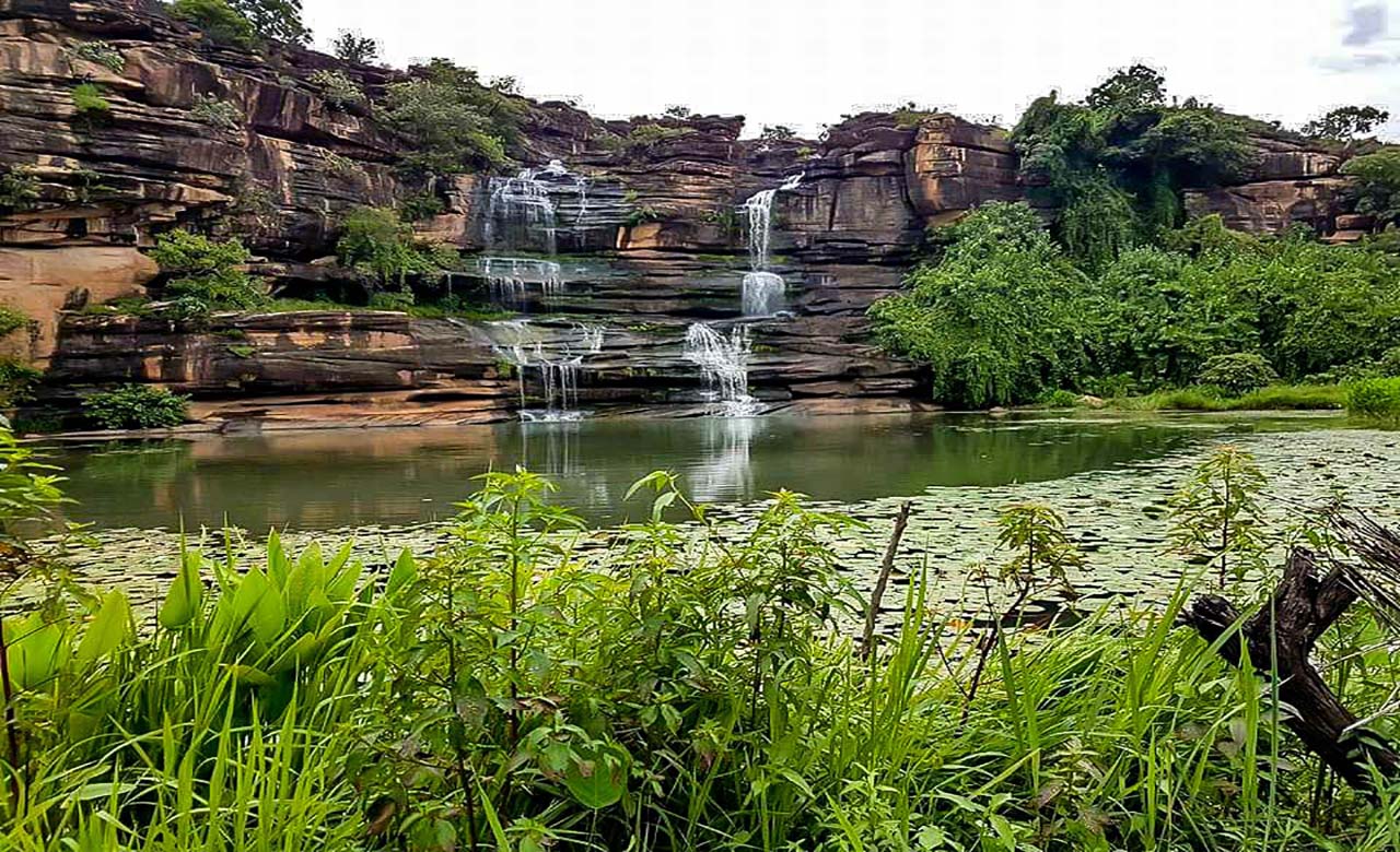
Koudou Falls
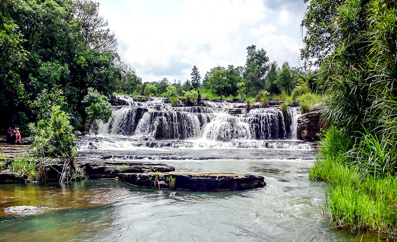
Situated in the province of Gnagna, the excellent Kudou Falls culminate at 262 m above sea level. It is a magnificent site that will allow you to live to the rhythm of the wildlife lulled by the roars of the lions. You will be able to appreciate the spectacle, the landscape and the fauna that these magnificent falls offer. You will also be able to go for a walk in a dugout canoe or on foot in this exceptional natural environment.
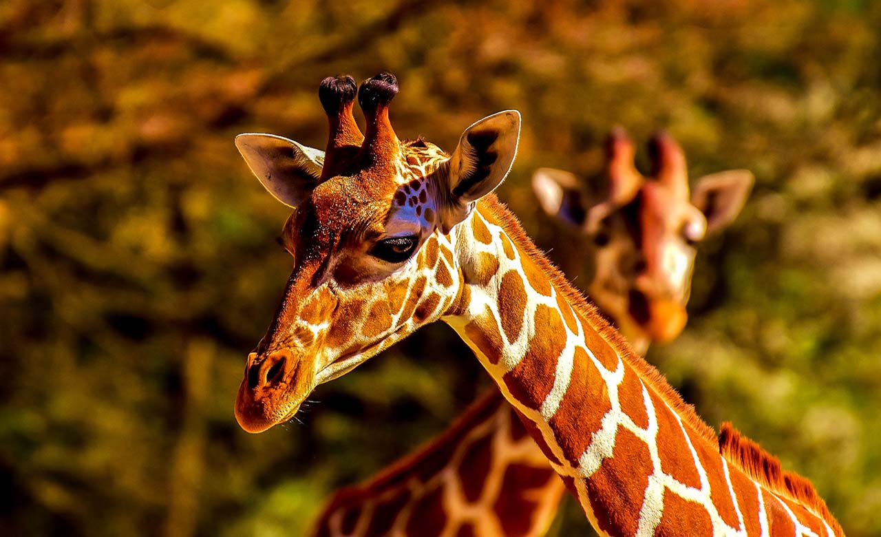
The ''W'' National Park of Niger

The W National Park of Niger is at the heart of a cross-border natural complex jointly managed by Benin, Niger and Burkina Faso. It was created in 1954, covers an area of nearly one million hectares and has been protected since 2007 by the Ramsar Convention. Niger’s W National Park has also been on the UNESCO World Heritage List since 1996. It is also recognized as a transboundary biosphere reserve. It is one of the most important national parks in West Africa. Its name comes from the fact that it revolves around the meander (Niger River) in the shape of a “W”. The park is famous
for its large mammals, including Cape aardvarks, baboons, buffaloes, caracals, cheetahs, elephants, hippos, leopards, lions, servals, warthogs, giraffes (Giraffa camelopardalis peralta), hippopotamuses, African manatees, crocodiles, harnessed guibs, buffaloes, and more than a hundred species of fish. In the gallery forests we find reptiles such as Nile lizards, pythons and a large population of migratory birds. About 350 species of birds and 454 species of plants have been identified.
Fada N'Gourma International Livestock Market
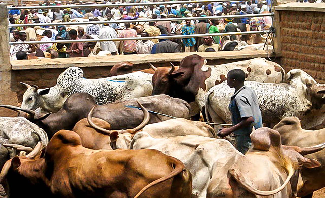
At the eastern exit of Fada, on the national road towards Niger, there is a large baked brick wall covering an area of 4.70 ha. This imposing arena, which is the pride of the town, was built in 2006 and serves as a cattle market. It is here that all those who operate in the livestock sector meet every Sunday to either sell or buy livestock. A Sunday appointment well on the agenda of many traders from West African countries, including Nigeria, Ghana, Ivory Coast and Togo. The market is divided into two compartments: the first is reserved for administration and traditional trade (second-hand
goods, drinks, food, cooking utensils, clothing accessories, etc.), and the second houses the livestock market. The latter is subdivided into several stalls corresponding to each category of livestock: large and small ruminants. 32 stalls are reserved for cattle, 64 for sheep and goats and 128 for poultry. On average 4,000 head of large ruminants are sold per market day.
The Sirba River

The Sirba, a river running through the entire Gnagna province in the Eastern region, is one of the most important rivers in Burkina Faso. It has its source in the Ganzourgou, which is the Central Plateau region, and flows eastwards through the Niger. It meets the Niger River halfway between the settlements of Gothèye and Karma in Niger, about 50 kilometres upstream from Niamey. Crossing this river during the rainy seasons is a real obstacle course.